365 Days of Movement: My Plan to Celebrate One Full Year

“Okay, I figured out how I’m going to celebrate 365 days of movement.” A bowl full of random exercises, ten extra minutes a day, and five back-to-back classes on the big day. That’s the ridiculous plan I built to hit my one-year milestone without skipping a single thing already on my schedule.

I’m pulling a mystery exercise from the bowl every day for the final stretch, adding classes on day 365, inviting my gym friends to lunch, and yes, there will be ice cream. Episode 100 is dropping that same day too. It’s silly, it’s sweaty, and it’s a real celebration of showing up.

⚠️This podcast is for entertainment purposes only and is not medical advice. Please consult a healthcare professional before starting any diet or exercise program.⚠️

Get more content

Join the FREE accountability group

Support our show by visiting our partners!

Check out our other partners

I Caved (And I’d Do It Again): What Happened When My Workout Plan Went Out the Window

“This will surprise exactly no one. I caved.” When the weather tanked my Thursday hike, I did what any reasonable person would do: headed straight to the gym instead. Sometimes the best move for your fitness plan is ignoring it.

I stacked a Pilates class and a Tabata session back to back, struggled with exactly one exercise (which honestly felt like a win), and lifted my 20-pound dumbbells feeling genuinely strong. If you’ve ever felt guilty for adjusting your routine on the fly, this one’s your permission slip.

⚠️This podcast is for entertainment purposes only and is not medical advice. Please consult a healthcare professional before starting any diet or exercise program.⚠️

Get more content

Join the FREE accountability group

Support our show by visiting our partners!

Check out our other partners

Why Doing Your Fitness Publicly Might Be the Only Thing That Actually Keeps You Going

“One of my biggest fears is failure.” I built my entire public presence around moving my body, and sometimes my body just won’t cooperate. Those are the days the guilt hits hardest, and I’m getting honest about working through it.

I talk about what daily accountability posts have done for my consistency, and why doing fitness out loud, in front of people, might be the missing piece for anyone who keeps falling off track. I’m also floating the idea of a Facebook group for accountability, nothing diet-culture, nothing toxic, just: did you move today?

⚠️This podcast is for entertainment purposes only and is not medical advice. Please consult a healthcare professional before starting any diet or exercise program.⚠️

Get more content

Join the FREE accountability group

Support our show by visiting our partners!

Check out our other partners

Show Up: How You Do One Thing Is How You Do Everything

“How you do one thing is how you do everything.” Three hundred days of movement didn’t just change my body. It changed my finances, my faith, my relationships, and my ability to handle whatever life throws at me.

I get into the surprisingly real connection between showing up for your fitness and showing up for every other part of your life, why that one small commitment might be what finally gets everything else unstuck, and the moments this year that were anything but easy. If something feels off right now, this one will make you think twice about where the actual fix starts.

⚠️This podcast is for entertainment purposes only and is not medical advice. Please consult a healthcare professional before starting any diet or exercise program.⚠️

Get more content

Join the FREE accountability group

Support our show by visiting our partners!

Check out our other partners

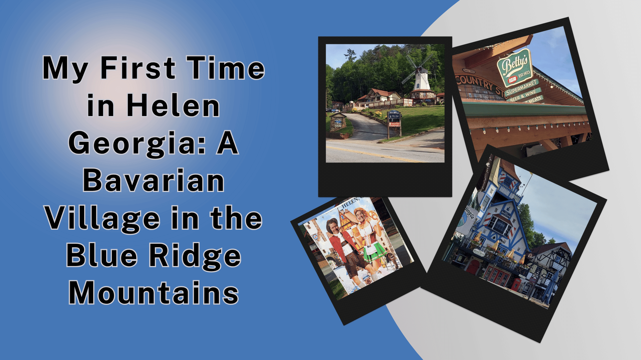
My First Time in Helen Georgia: A Bavarian Village in the Blue Ridge Mountains

My First Time in Helen Georgia_ A Bavarian Village in the Blue Ridge Mountains

Helen, Georgia is a charming Bavarian-themed town in north Georgia. Here’s what to know before you go, including the best days of the week to visit.

What is Helen, Georgia?

If you’ve never been to Helen, Georgia, you’re in for a treat. Or a head-scratcher. Possibly both.

Helen is a small mountain town in White County, Georgia, nestled in the Blue Ridge Mountains along the Chattahoochee River. In the late 1960s, the town transformed itself into a replica Bavarian alpine village. Every building downtown was redesigned to look like it belonged in southern Germany. Half-timbered facades, painted trim, flower boxes, and cobblestone-style streets. The whole nine yards.

It’s a tourist town through and through. But it leans into the theme so hard that it kind of works. There’s an annual Oktoberfest celebration that draws huge crowds. The shops sell German-inspired everything. Restaurants serve schnitzel and bratwurst alongside Southern comfort food.

Check out the official Helen Georgia visitor site for the latest info.

Know Before You Go

Some things I really wish I’d known before our trip:

  • Most shops are closed Monday and Tuesday (we learned this the hard way)
  • The best days to visit are Thursday through Sunday
  • The Hofbrauhaus restaurant is a must-visit for German food
  • The Glass Blowing Shop has stunning works of art and is open most days
  • Betty’s Country Store is a touristified grocery store worth checking out
  • Parking can be tight on busy weekends, and pretty much every lot charges to park
  • The Christmas shop doesn’t open until after Memorial Day
  • The Chattahoochee River runs right through town and is popular for tubing
  • Helen is only about 90 minutes north of Atlanta
  • Anna Ruby Falls is just a short drive away and worth pairing with a Helen visit
  • The town is walkable once you park
  • Many shops have outdoor flower displays and photo-worthy storefronts
  • Dogs are welcome on most streets and patios

How We Got to Helen

Jeremy and I rolled into Helen on Monday, May 4th after a full day of hiking Tallulah Gorge and Anna Ruby Falls. We checked into the Riverbend Hotel, dropped our stuff, and headed out to find dinner before walking the town.

Our timing was, in hindsight, terrible. We had two days in Helen, Monday afternoon and Tuesday morning. That’s the absolute worst window for visiting because most of the shops are closed both of those days.

I’m putting this in bold letters for anyone reading: visit Helen Thursday through Sunday. Just trust me on this.

Dinner at Hofbrauhaus Restaurant

The first night, we had dinner at the Hofbrauhaus Restaurant, which sits right along the Chattahoochee River. This place has been a Helen landmark for decades, and it shows in the decor and the menu. Long wooden tables, German-themed everything, and a menu full of authentic Bavarian dishes.

Our waitress was a young woman named Maddie, and she was an absolute delight. Friendly, attentive, and full of recommendations.

My full review of the joint is coming soon, but bottom line: we loved it! 

The Hofbrauhaus has its own website where you can check out the menu and hours: hofbrauhaushelenga.net.

The Riverbend Hotel

We stayed at the Riverbend Hotel in Helen. It was a comfortable spot with a pretty decent breakfast included for guests. Nothing fancy, but everything we needed after a long day of hiking and exploring.

The hotel sits along the river, which is a nice touch. You can hear the water flowing from your room if your window faces the right direction.

What Was Closed (and It Was a Lot)

This is the part of our Helen visit that I want to flag for anyone planning a trip. So much was closed.

The wine tasting room was closed.

The Christmas shop was closed (and apparently doesn’t open at all until after Memorial Day, so that one was a double whammy).

The candy shop we wanted to check out was closed.

Several other shops we walked past had signs saying they’d be back Thursday or Friday. Sigh…

We wandered the streets and peeked in windows at all these adorable little stores we couldn’t actually shop at. It was equal parts charming and frustrating.

What WAS Open

The Glass Blowing Shop was seriously a bright spot. They had some of the most beautiful pieces with shapes and styles that were absolutely mesmerizing. We didn’t buy anything, but I wanted to. The shop had everything from small pendants to large decorative pieces.

Betty’s Country Store was the other place we made sure to visit. It’s a regular grocery store on the surface, but it’s been touristified with souvenirs, local snacks, and Helen merchandise. We stopped in specifically because Jeremy’s late mother was named Betty. It felt like a small way to honor her memory by walking through a store that bore her name.

A handful of restaurants were open. The Hofbrauhaus, of course. A couple of other places along the main street. So you can definitely eat in Helen on a Monday or Tuesday, even if you can’t shop.

Walking Around Helen

Even with the shops closed, walking the streets of Helen was enjoyable. The Bavarian-style architecture is genuinely charming. Every building has those half-timbered facades and painted accents that make you feel like you’ve stepped into a German village.

We walked at least a mile through town, possibly more. We took pictures of the bridges, the river, the storefronts. We enjoyed seeing a guy fishing in the river too.

Tubing the Chattahoochee is a hugely popular activity in Helen, especially in summer. We didn’t have time for it on this trip, but it’s something I’d like to do on my next visit.

Breakfast at the Hotel

Tuesday morning, we ate breakfast at the Riverbend Hotel. They had a proper breakfast spread for guests, which was a nice perk. We did our stretch class, ate some yummy food (and even grabbed some snacks from their bar for the road), packed up, and then headed back out for one more walk through Helen before getting on the road home.

The morning light in Helen is really pretty. The town wakes up slowly, the streets are quiet, and you can take all the pictures you want without dodging crowds. If you do visit on a quieter day like we did, the morning hours are when the town shines.

What I’d Do Differently

If I could redo our Helen visit, here’s what I’d change:

– I’d visit Thursday through Sunday so everything would be open. This is the single biggest change I’d make.

– I’d plan time for Anna Ruby Falls and possibly a hike or two in nearby Unicoi State Park. There’s a lot of natural beauty in this area that gets overlooked because the town itself is so attention-grabbing.

– I’d try Bodensee Restaurant or Muller’s Famous Cafe for variety, even though Hofbrauhaus was great.

– I’d plan a day of tubing if the weather was warm enough.

– I’d visit Hofer’s Bakery in the morning for German pastries.

– I’d check out Nora Mill Granary, a working grist mill where you can buy fresh-ground grits and other Southern staples.

Why It’s Worth the Visit

Helen is one of those quirky destinations that you either love or find a little overdone. I fell on the love side, even with the shops being closed.

The Bavarian theme is so committed and so well-executed that it stops being kitschy and becomes its own thing. The food is excellent (at least at Hofbrauhaus). The setting along the river and in the mountains is genuinely beautiful. And the people we met were friendly and welcoming.

It’s the kind of place you visit once and then keep wanting to come back to during different seasons. Christmas in Helen is supposed to be magical. Oktoberfest is legendary. Spring brings out flowers everywhere. Summer is tubing season.

A Note About Oktoberfest

Helen’s Oktoberfest is one of the longest-running in the country. It typically runs from early September through early November. The town gets packed with visitors, live polka music plays everywhere, and the German beer flows freely.

I haven’t been to Helen during Oktoberfest yet, but it’s now officially on my list. If you’re a fan of German food, beer, and celebration, plan a fall trip.

Final Thoughts on Helen, Georgia

Helen is a delightful little surprise tucked into the Blue Ridge Mountains. It’s not a place you stumble into. You have to actively choose to drive there. But once you do, you’re rewarded with a unique town that doesn’t really exist anywhere else in the South.

Just please, for the love of all things German, visit Thursday through Sunday. Or even just Friday to Sunday if you want the full experience.

We had a wonderful time despite our timing miss. The Hofbrauhaus dinner alone was worth the trip. Maddie’s hospitality made it better. And the chance to walk a Bavarian village without leaving the United States is something everyone should experience at least once.

I’m already planning my return trip to Helen. Thursday through Sunday this time. Promise.

Why I Feel Guilty About Food (Even Though I Don’t Believe in Diets)

“I don’t subscribe to diets, but I am feeling guilty.” If a bowl of pasta still makes you feel like you did something wrong even though you’ve ditched diet culture, this one’s for you. I’m getting honest about a stretch of relentless sweet, carb, and soda cravings, and the guilt that showed up uninvited right along with them.

I walk through what I’m actually doing about it: moving my body more, reaching for water first, and giving myself real, mindful permission to indulge so the guilt doesn’t spiral into bingeing. This isn’t a lecture on willpower. It’s a reminder that you can be active, mindful, and still completely human.

⚠️This podcast is for entertainment purposes only and is not medical advice. Please consult a healthcare professional before starting any diet or exercise program.⚠️

Get more content

Join the FREE accountability group

Support our show by visiting our partners!

Check out our other partners

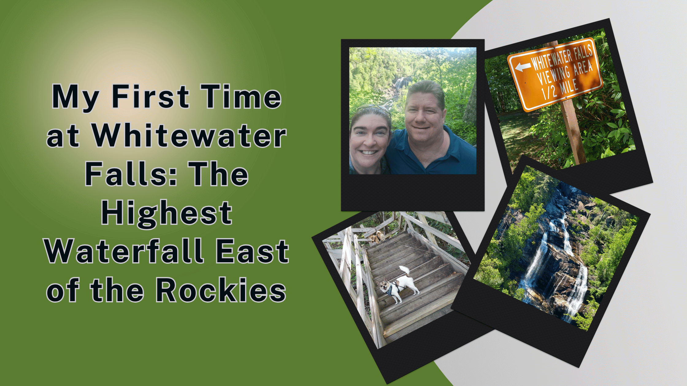
My First Time at Whitewater Falls: The Highest Waterfall East of the Rockies

My First Time at Whitewater Falls_ The Highest Waterfall East of the Rockies

Whitewater Falls in North Carolina drops 411 feet and is gorgeous. Here’s what to expect on this short but stunning hike in Nantahala National Forest.

What is Whitewater Falls?

If you’ve never heard of Whitewater Falls, allow me to introduce you to the highest waterfall east of the Rocky Mountains.

Upper Whitewater Falls drops 411 feet down a rocky cliff in the Nantahala National Forest in North Carolina. There’s also a Lower Whitewater Falls in South Carolina that drops another 400 feet. Together, the falls span 811 feet of waterfall drama between the upper and lower sections.

The Upper Falls is the one most visitors see. It’s about an hour and a half southwest of Asheville, North Carolina, near the South Carolina state line. The trailhead is just off NC-281, near Cashiers.

You can read more about it on the USDA Forest Service page for Whitewater Falls.

Know Before You Go

A first-timer’s guide to Whitewater Falls so you don’t get caught off guard:

  • There’s a small parking fee (usually $3 to $5 per vehicle, paid at the kiosk)
  • The America the Beautiful park pass gets you in free
  • The paved trail to the upper overlook is about a quarter mile each way
  • Adding the lower overlook means 154 wooden stairs each direction (so 308 total round trip)
  • The full hike is about 1 mile round trip when you do both overlooks
  • The trail is wheelchair-friendly only to the upper overlook
  • Dogs are allowed on leash (but you’ll want to carry them up and down the stairs!)
  • Restrooms and picnic tables are available at the parking area
  • No cell service in most of the area
  • Open dawn to dusk daily
  • Bring water – and more than you think you will need! (especially in warmer weather)
  • Several deaths have happened from people venturing off the trail. Seriously! There are signs warning people to stay on the path for a reason!
  • No camping or fires allowed at the recreation area

How We Ended Up at Whitewater Falls

Sunday, May 3rd was supposed to be the day we hiked Whitewater Falls. Then it rained all day Saturday, and we got delayed at California Dreaming in Augusta with that whole steak saga. So we ended up tackling Whitewater Falls on Sunday after a Bojangles breakfast (which was good, even if it wasn’t healthy) and a stop at Bobby Brown State Park.

By the time we made it to the Nantahala National Forest, the rain was completely cleared from the radar and the day was sunny and bright. And the falls? Well, they were running strong thanks to all that previous day’s precipitation.

The Walk to the Upper Overlook

The paved trail starts at the end of the parking lot and curves into the woods. You’re immediately in this beautiful Appalachian forest with tall trees, ferns, and the kind of dense green that makes you forget you’re not far from a major road.

The first quarter mile is easy. The grade is gentle, the surface is paved, and you can hear the falls before you see them. That’s one of my favorite things about waterfall hikes. The sound builds gradually, and your anticipation builds with it.

When you reach the upper overlook, you get your first view of Upper Whitewater Falls cascading 411 feet down the cliff. The view is wide and impressive, though some trees do partially block the bottom of the falls from this angle.

If you’re not up for taking all those stairs, the upper overlook gives you a great experience and you can turn around here. The trail is fully accessible to wheelchairs and strollers up to this point.

Then We Did the Stairs

We decided to go for it. I workout after all. Ha!

The lower overlook is reached by going down 154 wooden steps. That’s a lot of stairs. The grade is steep, and the railings are basically required. You feel like you’re descending into the canyon itself.

But here’s the payoff. The lower overlook gives you a much better, unobstructed view of the entire waterfall. The platform is wide enough to fit a dozen people or so, though the prime center spots are limited and you may have to wait your turn for the best view.

Standing at the lower overlook with the falls thundering down across the canyon was one of those moments where you forget to take pictures because you’re just staring. The water sparkles. The mist drifts up. The sound is incredible.

We took plenty of pictures eventually, of course. We always do.

The Climb Back Up

I’ll be honest. The 154 stairs back up were harder than going down.

By the time we hit the top, my calves were on fire and I was breathing hard. Jeremy was doing better than me because of my left knee issues, but it was still pretty intense for both of us! We took a couple of breaks on the way up because we knew that pushing too hard would just leave us shaky.

If you’re not in great shape, those stairs are a serious workout. Take your time. Use the railings. Bring water.

The Detour to Duke Energy’s Bad Creek

After we finished Whitewater Falls, we drove over to the Duke Energy Bad Creek Hydroelectric facility. They have a turbine pump that’s part of their pumped storage system, and you can see an overlook of Destination Oconee from there. (That’s O-C-O-N-E-E if you’re looking it up.)

It’s not a hiking destination, but it’s a cool stop if you’re already in the area. You get a different vantage point on the gorge system and Lake Jocassee. The Foothills Trail also has an access point here, which leads to the Lower Whitewater Falls if you want a longer hike.

The Foothills Trail

Speaking of the Foothills Trail… We did a small section of it called the Lake Jocassee Foothills Trail. The full Foothills Trail is 77 miles long and stretches across the Blue Ridge Mountains, but you can do short sections without committing to a multi-day hike.

If you’re an experienced hiker, you can actually do an 8.5-mile one-way hike from the Upper Whitewater Falls overlook along the Foothills Trail to the Lower Whitewater Falls overlook in South Carolina. That requires shuttle planning or a serious commitment to backtracking.

A shorter option is to access the Lower Whitewater Falls from the Bad Creek trailhead, which is about a 2-mile one-way hike. The total distance is roughly 4.3 miles round trip and considered moderate.

We didn’t have the energy for that on our trip since we were doing so many hikes and walks, but I’d love to come back and do it someday.

Moody Springs and Other Pretty Spots

On our way out of the area, we stopped at Moody Springs and snapped a quick picture. It’s a small, easy-to-miss spot, but it’s pretty.

The whole region around Whitewater Falls is full of these little surprises. Pretty creeks, scenic overlooks, hidden trails. If you’ve got a full day, you can chain together multiple waterfall stops in one outing.

Wildlife and Plants

The trail to Whitewater Falls is known for wildflowers, especially in early to mid April. We were just past peak wildflower season when we visited in May, but I still spotted some pretty blooms along the trail.

Common wildflowers in the area include Vasey’s trillium, Catesby’s trillium, trailing arbutus, mayapple, sweet white violet, and showy orchid. If you’re a flower person, plan your visit for spring.

I didn’t see any wildlife up close, but the Nantahala National Forest is home to black bears, white-tailed deer, wild turkeys, and various smaller animals. Keep an eye out, especially in early morning or late afternoon.

What I’d Do Differently

If I could redo our Whitewater Falls visit, here’s what I’d change:

– I’d give myself more time. We were trying to fit too much into one day, and Whitewater Falls deserves at least a couple of hours.

– I’d add the Lower Falls hike from Bad Creek if my legs were up to it. Knowing now that Lower Whitewater Falls is just as impressive (though smaller), I’d want to see both.

– I’d pack more water. The hike up those stairs takes more out of you than you’d expect.

– I’d visit during the wildflower season if possible. Mid-April is supposedly peak, and the trail is supposed to be incredible.

Why It’s Worth the Stop

Whitewater Falls is the kind of natural wonder that reminds you why you take road trips. You drive for hours, you park, you walk a half mile, and suddenly you’re standing in front of one of the most impressive waterfalls in the eastern United States.

The fact that it’s named “Whitewater Falls” in a region with about ten thousand waterfalls is telling. It earned that name.

Final Thoughts on Whitewater Falls

If you’re driving anywhere near the North Carolina and South Carolina border, make the detour to Whitewater Falls. The parking fee is cheap, the hike is short, and the views are unforgettable.

The 154 stairs to the lower overlook are absolutely worth it if you’re physically able. The upper overlook is great, but the lower view is the one that knocks your socks off.

This was hands down one of the best hikes of our entire road trip. We were tired, we were sore, and we were stunned by the beauty of it all.

I’m already planning my return trip. Next time, I’m tackling the Lower Falls too.

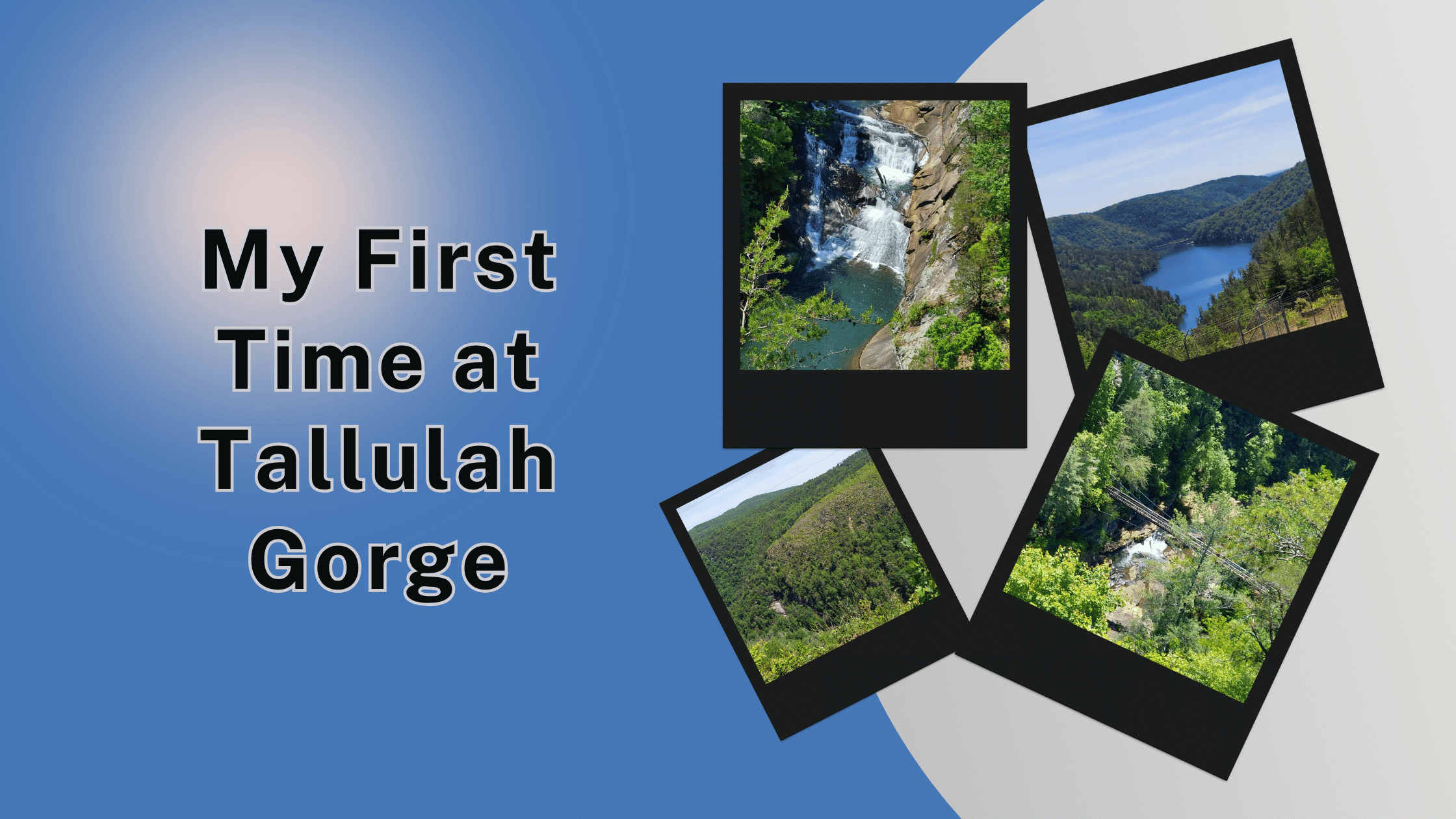
My First Time at Tallulah Gorge: Stairs, Rim Trails, and Why We Missed Most of the Trail

My First Time at Tallulah Gorge_ Stairs, Rim Trails, and Why We Missed Most of the Trail

Tallulah Gorge State Park in Georgia is breathtaking but tricky for dog owners. Here’s what we learned hiking the North Rim Trail with our Pampered Pomchis.

What is Tallulah Gorge?

If you’ve never heard of Tallulah Gorge State Park, let me catch you up. It’s tucked into Rabun County in northeast Georgia, about an hour and a half north of Atlanta. The gorge itself is two miles long and nearly 1,000 feet deep, which makes it one of the most spectacular canyons in the eastern United States.

There are six waterfalls inside the gorge, a swaying suspension bridge that hangs 80 feet above the river, and over 20 miles of trails. Tightrope walkers have actually crossed the gorge twice, including the legendary Karl Wallenda in 1970. You can still see the towers he used.

You can get all the planning details on the Georgia State Parks website.

Know Before You Go

Before I get into our experience, here’s what I wish I’d known before pulling into the park:

  • Parking is $5 per vehicle and can be paid in cash or by scanning a QR code with your phone
  • Dogs are NOT allowed on the staircase down to the suspension bridge, the gorge floor, or the Sliding Rock Trail
  • Leashed dogs ARE allowed on the rim trails, including the North Rim and South Rim
  • The Hurricane Falls Loop down to the gorge floor has 1,099 stairs total (not for the faint of heart)
  • The suspension bridge is accessed via 310 steps down from the rim
  • Permits for the gorge floor are free but limited to 100 per day, available at the Jane Hurt Yarn Interpretive Center
  • The interpretive center has restrooms, water, and a small museum
  • Trails are open year-round, though waterfall flow varies depending on water releases
  • Whitewater release weekends close the gorge floor to hikers
  • Bring proper hiking shoes, especially if you’re tackling the stairs
  • The park is open 8 a.m. until dark, with the office open 8 a.m. to 5 p.m.
  • Cell service is limited inside the park

How We Ended Up at Tallulah Gorge

Monday, May 4th was a packed day for Jeremy and me. We started by feeding goats at Goat Landing and Ladybug Landing in Tiger, Georgia. We stopped at the official Bigfoot Crossing for a fun photo op. We had drinks at Kringle Trading Company. And we took in the view at Tallulah Point Scenic Overlook before driving into the state park itself.

By the time we arrived at the park, we’d already had a full morning. Our Pomchis, Baileys and Kahlua, were riding along with us and ready for a stretch.

Where the Dogs Couldn’t Go

This is the part of Tallulah Gorge that surprised us. We knew it was a state park, and most Georgia State Parks allow dogs on trails. What we didn’t realize was that this park has very specific restrictions on where pets are welcome.

The suspension bridge? No dogs.

The 310 stairs down to the bridge? No dogs.

The Hurricane Falls Trail to the gorge floor? No dogs.

The Sliding Rock Trail? No dogs.

The reason is actually pretty thoughtful. The stairs have grippy metal surfaces designed for human feet. Those same grips can shred a dog’s paw pads, especially small dogs like our Pomchis. It’s a safety issue, not just a pet policy.

So we had a decision to make. Either skip the famous suspension bridge or take turns watching the dogs while one of us hiked down.

What We Actually Did

We chose to focus on the rim trails, where Baileys and Kahlua were welcome on leash for this trip.

We did about half a mile on the North Rim Trail, which gave us our first view of the gorge from above. The first overlook is about a quarter mile from the trailhead, and it’s stunning. You’re standing on the edge of a 1,000-foot drop, looking out at the dramatic walls of the gorge with waterfalls visible in the distance.

Then we walked at least another half mile around the park, taking in different overlooks and stretching our legs. All together, we hiked about a mile at Tallulah Gorge, all on the rim trails where the dogs could come along.

The North Rim Trail and South Rim Trail are both on mulched paths with a moderate incline. They’re rated easy to moderate. Together, they make about a 3-mile round trip if you do the full loop.

What We Missed (and Don’t Feel Bad About)

We didn’t go down the 310 stairs to the suspension bridge.

Part of me regrets it because the bridge is the iconic photo op for the park. The other part of me knows that even if Baileys and Kahlua had been allowed, hiking 310 stairs down and then 310 stairs back up after a long day of driving probably wasn’t a smart choice.

I read later that park rangers do a lot of rescues on those stairs. People think they can handle the climb back up, then realize halfway through that they can’t. The rangers told one visitor that the climb is “no joke,” and a lot of people overestimate themselves.

If we ever go back, we’ll plan a full day at Tallulah Gorge, leave the dogs at home (or at least in a hotel because we take our dogs on most trips!), and tackle the gorge floor properly with permits and snacks and water.

The Views From the Rim Were Still Incredible

Even without the suspension bridge experience, the rim trails delivered some of the most beautiful views of the whole trip. The waterfalls were visible from multiple overlooks. The drop into the gorge is genuinely vertigo-inducing in the best way. And the trails themselves are well-maintained and easy to follow.

We saw L’Eau D’or Falls and Tempesta Falls from the rim overlooks. The North Rim has the best general views of the falls, while the South Rim offers different angles. If you’ve only got time for one side, locals seem to recommend the North Rim.

The Interpretive Center

The Jane Hurt Yarn Interpretive Center at the entrance is also worth a stop. It functions as part visitor center, part mini-museum. There are exhibits about the history of the gorge, the Cherokee people who originally lived in the area (they called the gorge “Ugunyi”), the Victorian-era resort town that once existed here, and the wildlife and plants that still thrive in the gorge today.

The center also has a gift shop. We didn’t buy anything, but the kids who were there with their parents looked like they were having a great time exploring the exhibits.

Wildlife and Plants Worth Knowing About

Tallulah Gorge is home to several protected species. The persistent trillium, the monkey-face orchid, and the green salamander all live within the gorge ecosystem. Stay on the trails and don’t pick or disturb any plants.

We didn’t see any wildlife up close, but the area is known for white-tailed deer, wild turkeys, various raptors, and small mammals. Keep an eye out if you’re observant.

What I’d Do Differently

If I could redo our Tallulah Gorge visit, here’s what I’d change:

– I’d plan a full day at the park, not just an afternoon stop. The amount you can do here easily fills four to six hours if you’re a hiker.

– I’d leave the dogs in a hotel so I could take the stairs down to the suspension bridge.

– I’d get a free gorge floor permit early in the morning (they go fast on busy days, available at the interpretive center starting at 8 a.m.).

– I’d pack more water and proper hiking shoes (we had decent shoes but not great ones for serious stair climbing).

– I’d visit Tallulah 1882, the coffee and small-bites spot right across from the park entrance that other reviewers rave about.

Final Thoughts on Tallulah Gorge

Tallulah Gorge State Park is genuinely one of the most beautiful natural spots I’ve ever seen. 

The drama of the gorge, the waterfalls, the suspension bridge, the rim trails, all of it lives up to the hype.

It’s just not the most dog-friendly destination if your dogs are small and you want to do the iconic hikes. The rim trails are still beautiful and worth visiting with your fur babies, but the famous suspension bridge experience is off-limits for them.

If you’ve got dogs like Baileys and Kahlua and you want to see Tallulah Gorge, plan ahead. Either bring backup pet care for the day or accept that you’ll be hiking the rim trails only. Both are great options. The trick is knowing before you go.

We had a wonderful time. We took beautiful photos. We made memories. And now we have a reason to come back without the dogs and do the stairs.

Sometimes a trip leaves you with unfinished business. Tallulah Gorge is one of those for us.

I Cried on a Mountain Last Week: How Should I Celebrate 1 Year of Maximum Effort?

“What do you do to celebrate milestones?” Last week I stood at a mountain overlook and cried, and the view wasn’t the reason. This time last year, I physically couldn’t have made that hike. In less than two months I’ll hit 365 days of maximum effort, and I have no idea yet how to celebrate it.

I talk through what one year of going all in has actually looked like (over 700 workouts, 624 classes, four pant sizes down, going from 3-pound weights to 20-pound dumbbells), and the half-formed ideas I’m wrestling with for the big day: 365 squats and push-ups, an espresso martini and tiramisu cheesecake, or back-to-back classes all day. I want your vote.

⚠️This podcast is for entertainment purposes only and is not medical advice. Please consult a healthcare professional before starting any diet or exercise program.⚠️

Get more content

Join the FREE accountability group

Support our show by visiting our partners!

Check out our other partners

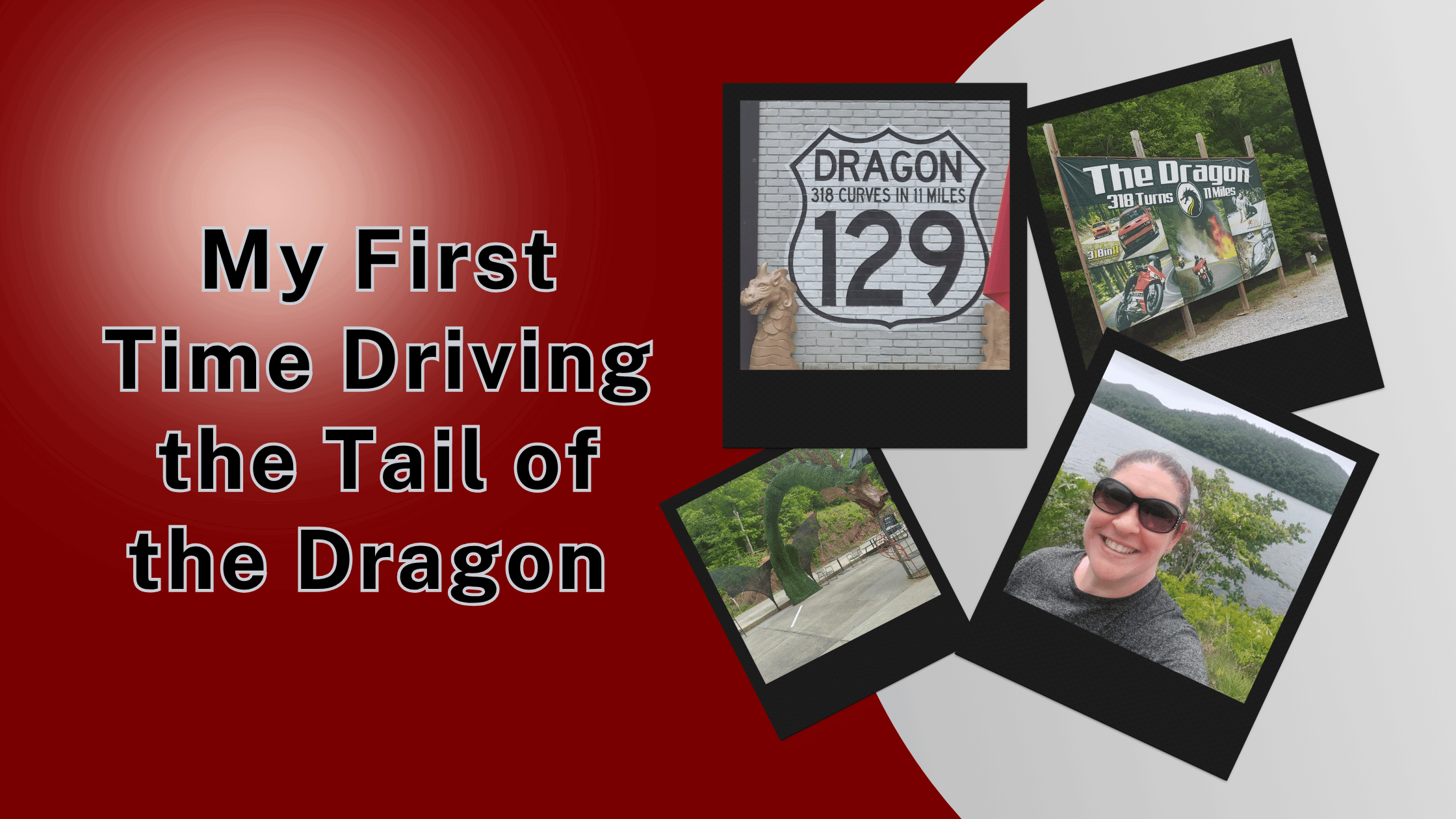
My First Time Driving the Tail of the Dragon and Why Photos from 129 Caught My Eye

Driving the Tail of the Dragon was both terrifying and beautiful. Plus, why the roadside photographers on US 129 are running a clever little business.

What is the Tail of the Dragon?

Before our road trip, I’d heard about the Tail of the Dragon in passing but didn’t really know what it was. So in case you’re like I was, let me catch you up.

The Tail of the Dragon is an 11-mile stretch of US Route 129 that runs between Tennessee and North Carolina. It’s known for one wild fact. There are 318 curves packed into those 11 miles. That’s almost 29 curves per mile, which is insane.

It straddles the border at Deals Gap, which sits between the Great Smoky Mountains National Park and Cherokee National Forest. There are no houses, no driveways, no intersections, and no businesses along the road itself. Just curves, trees, and (sometimes) other drivers and motorcyclists.

You can read all about its history and current conditions on the official Tail of the Dragon website.

Know Before You Go

If you’re planning to drive the Tail of the Dragon for the first time, here are some things you should know:

  • The road is two lanes with no shoulders and very few pull-offs, so committed driving is the only option once you start
    • We used these pull-offs a LOT to let people pass us…
  • There are 318 curves in 11 miles, including some hairpin turns
  • Motorcyclists love this road and tend to drive it fast, so be alert for bikes
  • Trucks and large vehicles are not recommended (and in some sections, prohibited)
  • The road runs between Deals Gap, North Carolina and the Tabcat Creek Bridge in Tennessee
  • The Deals Gap Motorcycle Resort sits at one end and is a fun stop for snacks, swag, and the famous Tree of Shame
    • I regret we missed seeing this!
  • Cell service is spotty to nonexistent along most of the route
  • Best weather is dry and clear, since rain makes the curves more dangerous
  • Plan extra time, because you’ll want to stop at any pull-off you can find for pictures
  • Don’t try to drive it after dark unless you really know the road

Why I Was Nervous

I’m going to be honest with y’all. Windy roads make me anxious.

I’ve never exactly been a fan of mountain driving. The combination of tight curves, steep drops, and unfamiliar terrain stresses me out. So when Jeremy and I decided to add the Tail of the Dragon to our route home from Florida, I was already psyching myself out before we even got there.

Jeremy was driving, which helped. He’s a steady, patient driver who takes mountain roads at a comfortable pace. But even with him at the wheel, I was gripping the door handle for most of the 11 miles.

What It Actually Felt Like

The first few curves weren’t bad. I thought, “Okay, this isn’t so terrible.” Then we hit a hairpin curve, and I felt my stomach drop into my shoes.

Some of the curves are named, by the way. There’s Copperhead Corner, Hog Pen Bend, Wheelie Hell, Shade Tree Corner, Mud Corner, Sunset Corner, Gravity Cavity, Beginner’s End, and Brake or Bust Bend. Those names exist for a reason.

The good news is that the scenery is genuinely beautiful. Even though most of the road is just walls of trees on both sides, you catch glimpses of mountain views, rocky overhangs, and the occasional creek or stream. 

Some of the spots we saw were so pretty that I wished we could pull over. But there aren’t many places to do that safely.

After 11 miles, we made it through. I was relieved. Jeremy was happy. And I had a story to tell.

The Roadside Photographers

This is the part of the Tail of the Dragon story I really want to talk about.

As we drove the road, I started noticing tents set up at strategic spots along the curves. Inside each tent were two photographers. They had professional cameras and stood completely still as cars and motorcycles passed by, snapping pictures of every vehicle that came through.

I counted at least two companies with their own tents. 129 Slayer and 129 Photos. There may have been others I missed.

I learned later that there’s a third major company called Killboy, plus a smaller one called Moonshine Photo. So there are usually four or five different photography businesses working the same 11 miles of road.

You can find them online at 129photos.com and at the 129 Slayer store. Each one has a website where you search by date and a rough time estimate, find your vehicle, and buy your photos.

How the Photos from 129 Business Works

The system is pretty clever. Photographers shoot every day from about 9 a.m. to 6 p.m. Each photo gets tagged with the date and time. You go home, pull up the company’s website, search by the date you drove the road, and find your vehicle.

The downloads start at around $8.50 for a high-resolution digital image. That’s the entry-level price for a basic download. You can also buy prints, framed photos, photos on mugs and tumblers, road signs with your image, and posters. Different sizes and products cost different amounts.

We didn’t buy any photos because we drove an unremarkable vehicle, and honestly, the experience of being on the road was more important to me than the souvenir. But if we’d been on a motorcycle or in a sports car, I might have grabbed one.

My Honest Take on the Business

As someone who used to be a photographer myself, I respect this hustle.

Think about it. You set up a tent in a popular spot. You take pictures all day. You tag and upload them to a website. People go home, find their photos, and pay you. You barely have to interact with customers. You sell digital downloads with practically zero overhead after the initial setup.

Is it a fortune? Probably not. But it’s a clever way to make a living doing photography in a beautiful spot, and the demand is consistent because thousands of drivers and motorcyclists hit this road every year.

I do wonder how the permitting works.

– Are these photographers permitted by the local jurisdictions?

– Are they private contractors operating on public land or private property?

I couldn’t find a clear answer, and I’m curious about the legal side. But the customers don’t seem to care, and the business has been operating for years, so somebody must have it figured out.

For anyone reading this who’s a creative entrepreneur, I think there’s something interesting here. Find a high-traffic location with built-in demand. Set up a system. Let the technology and the volume do the work.

What I’d Do Differently for the Tail of the Dragon

Looking back on driving the Tail of the Dragon, I have a few thoughts.

I’d give myself more mental prep time. Knowing that 318 curves was going to feel like 318 curves would have helped me brace for it.

I’d consider doing the drive earlier in the day when I’m fresher and more alert. We did it later in the trip when we were already tired from days of driving and hiking.

I’d plan to stop at the Deals Gap Motorcycle Resort at the end. We didn’t make time for it, and that’s where you can see the Tree of Shame (a tree decorated with motorcycle parts from crashes) and pick up the official Dragon Sticker.

I might take a friend who isn’t scared of curves so my anxiety wouldn’t dampen the experience for Jeremy.

The Lake or River After the Dragon

After we finished the Tail of the Dragon, we drove past this beautiful body of water on the side of the road. I thought it was a lake at first. Looking back, it was probably a river. The scenery was so pretty that we slowed down just to look.

The road through the Smoky Mountains region has so many of these little surprises. Lakes, rivers, scenic overlooks, and forest stretches that go on for miles. The Tail of the Dragon may be the famous part, but the rest of the drive is honestly just as beautiful (and a lot less terrifying).

Would I Drive It Again?

Honestly? Yes. Probably still as a passenger though. I have ZERO interest in ever driving it.

If you’re a thrill seeker, a motorcyclist, or a sports car enthusiast, the Tail of the Dragon is a bucket list drive. You’ll love it.

If you’re like me and prefer your roads straight and your scenery accessible by easy walking trails, the Tail of the Dragon is something you do at least once to say you did it. Then you find a less stressful route home.

Final Thoughts on the Tail of the Dragon

The Tail of the Dragon lived up to its reputation. 318 curves, 11 miles, terrifying and beautiful all at once.

The photography hustle along the route was an unexpected highlight for me. It’s the kind of clever side business that makes you think about all the other ways photographers and creative entrepreneurs can build income streams in unique places.

Would I recommend driving the Tail of the Dragon? Absolutely, if you’ve got the stomach for it. Just make sure you have a steady driver, a clear day, and maybe a slice of cheesecake waiting for you at the end as a reward.

Next time, I might just buy myself one of those Dragon photos. Even from a regular old SUV.